
Birding at Brent Reservoir
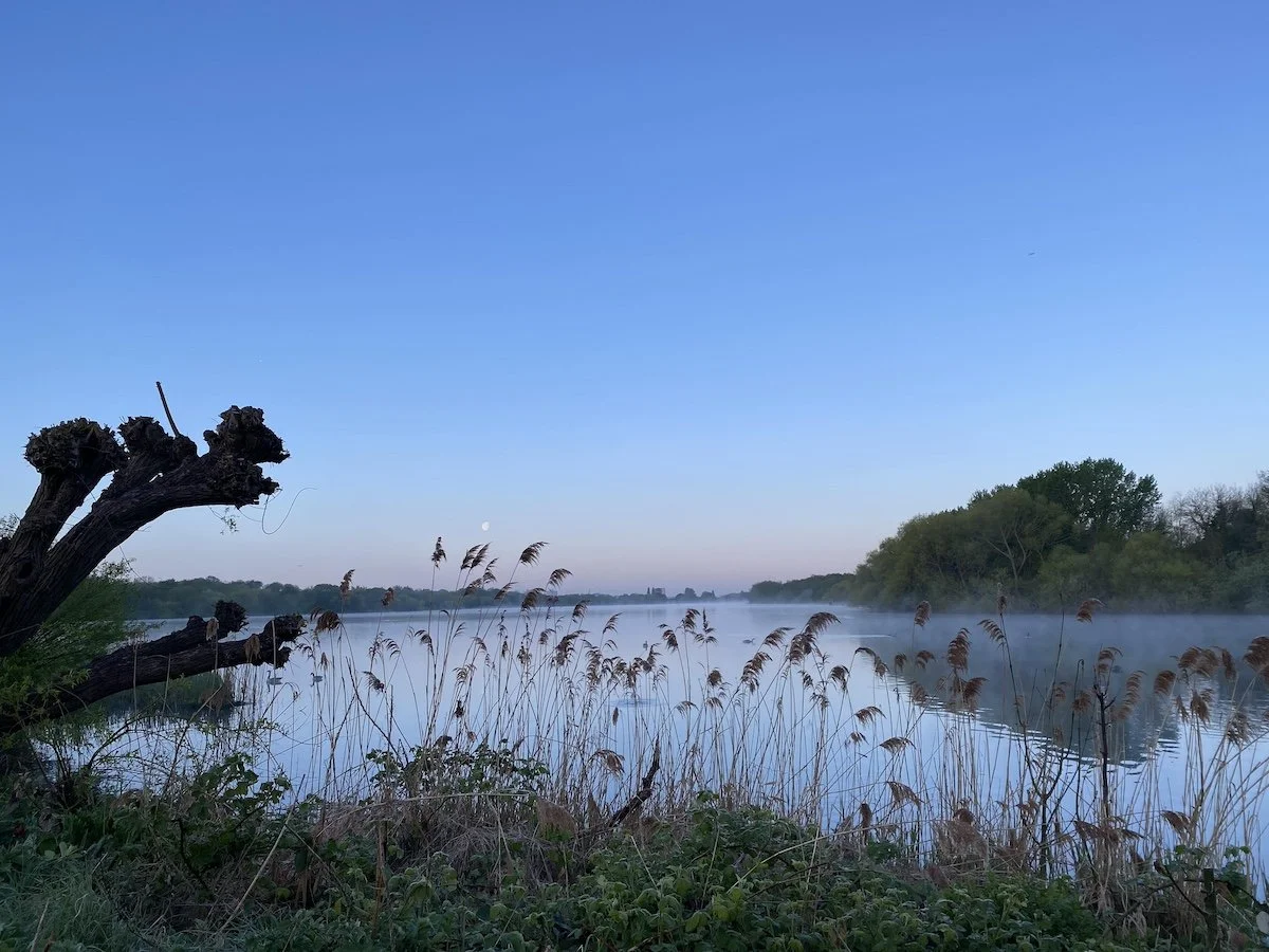
Main arm of Brent Reservoir on a spring morning at dawn
More is known about early birding at Brent Reservoir than any other London site. Records date back to the nineteenth century. Over 252 species have been recorded over the years, the most recent a glossy ibis in September 2025. Here, we give you the inside track on where to go and what to look for.
Access
There is 24-hour access to all the open spaces surrounding Brent Reservoir (Welsh Harp). Most of the key birding areas are accessible from the northern side. The southern side needs to be visited separately via Neasden Recreation Ground as the trash screen and industrial estate in the SE corner, and the dam at the western end preclude a circular walk.
Car
Click pin for Google Maps location
Free resident parking bays in📍 Woolmead Avenue, NW9 (except weekdays between 10am-11am), off Cool Oak Lane, close to key areas.
Small free car park in📍 Woodfield Park, 200m further up Cool Oak Lane on the left before the bend in the road.
Northern end of site:📍 Pay and display car park off Goldsmith Ave.
Western end of site:📍 Large free car park at the end of Birchen Grove next to sailing club..
Other options: Street parking in Kinloch Drive, Townsend Lane.
To visit the southern side, park in Aboyne Road and use footpath to Neasden Recreation Ground, bordering reservoir.
Rail
Hendon (Thameslink), 5-minute walk via West Hendon Broadway to Cool Oak Lane.
Tube
Hendon Central (Northern Line), 15-minute walk, via Vivian Avenue and Station Road.
Wembley Park (Metropolitan or Jubilee Line) + bus 297 or 182 to Blackbird Hill + walk via Birchen Grove.
Bus
West Hendon Broadway via routes 32, 83, 142, 183.
Blackbird Hill via routes 182, 245, 297, 302.
Disabled Access
Ramps to both the East Marsh main hide and North Marsh viewing platform but the paths to and from are uneven and often muddy. Wheelchairs can still reach a viewing platform overlooking the main reservoir just west of Cool Oak Bridge.
Food and Toilets
No toilets or cafe on site. Nearest: Birchen Grove Garden Centre (NW9 8RY), Sainsbury’s (NW9 6GH), Starbucks (NW9 7DE).
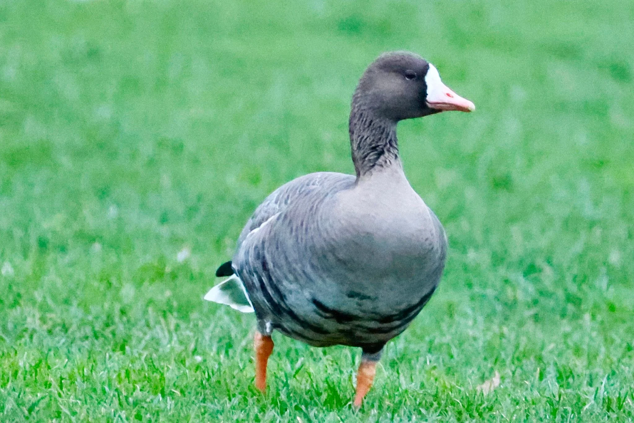
Russian White-Fronted Goose: seven visited in December 2025
Main Birding Spots (North of Cool Oak Lane)
Click pin for Google Maps location
📍North Marsh Public Hide & Viewing Platform: Views over North Marsh and new restoration. To reach these, follow main footpath north from the west end of Cool Oak Lane bridge for 300m. The North Marsh has benefitted from a major restoration programme by Canal and River Trust in 2025-2026 that has opened up overgrown canals, ponds and islands in the north-west corner. Look out for: Gadwall, Great Crested Grebe, Little Egret, Teal, Common Snipe, Green Sandpiper
📍The Dump: Scrub and rough grass on edge of📍 West Hendon Playing Fields. Look out for: Common Whitethroat (summer), spring and autumn migrants e.g. Whinchat, Spotted Flycatcher, Tree Pipit, Meadow Pipit
Main Birding Spots (South of Cool Oak Lane)
East Marsh Hides: two hides (📍Main Hide and📍 Heron Hide) that require a key (obtainable through the Welsh Harp Conservation Group), although anyone is welcome in the hides while a keyholder is present. Accessed via the green metal gate to the📍East Marsh Path (beside the builders yard), on the east side of Cool Oak Lane bridge. Not a keyholder? The hides are often open on Saturday and Sunday mornings. Among the best days to visit are the monthly guided walk days organised by RSPB North West London group and/or Canal and River Trust, which end in the main hide. Look out for: Common Tern (summer), Common Snipe, Jack Snipe (winter), various migrants and unexpected passage visitors.
📍East Marsh Path: Even without access to the hides, the path along the east shore can be worth exploring. It runs between the back gardens of houses and the shoreline, offering secluded woodland and reed fringe, with a couple of viewing points over the reservoir. The path continues past Heron Hide to a wooden barrier, beyond which is the River Brent trash screen. Turn back and retrace your steps. (Or there are a couple of overgrown paths that exit onto the A5/Priestley Way.) Look out for: Blackcap, Willow Warbler, Reed Warbler, Cetti’s Warbler
📍Shrike Field: Wide open field of scrub and rough grass, copses of trees and woodland edge at western end of Capital Ring footpath on north shore. Good for migrants. Look out for: Common Whitethroat, Lesser Whitethroat, Garden Warbler, Stonechat
📍Leo's Pond: Lower edge of Shrike Field. Small pond with reed fringe. Look out for: Reed Warbler, Sedge Warbler, Reed Bunting
📍Dam and Sailing Club: Viewable from Leo's Pond with scope or binoculars. Look out for: Common Swift, Sand Martin, Swallow, Common Sandpiper
📍Phoenix Canoe Club Pontoons: Halfway along northern shore. Good for gulls and ducks.
📍Neasden Recreation Ground (South side of reservoir, see Access above) Grass, scrub, woodland.
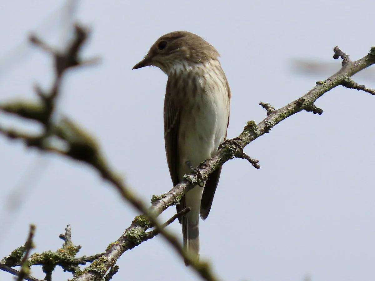
August and September are good months for Spotted Flycatcher
Suggested Circular Walk (Northern Side)
Click pin for Google Maps location
Starts on📍 Cool Oak Lane Bridge. Total distance: 2.8 kilometres (1.75 miles).
Cross the road by traffic lights at west end of bridge. Follow the north bank of the main reservoir along the Capital Ring towards the dam end. Wooden viewing platform overlooking the main reservoir after 20m. (Scope views towards the east marsh, tern rafts.)
Continue along path to📍 Phoenix Canoe Club. Gulls and ducks often assemble on the pontoons. Small fields of scrub along the way on the right for passerines, woodpeckers, kestrel.
Continue to the Welsh Harp Open Space (Brent Council) sign. Briefly divert to small Bomb Crater Pond on left at water's edge and views across middle of reservoir. Back on main path continue another 50m until the view opens out over a wide field either side of path (📍Shrike Field, good for migrants), with views over the western end of reservoir and dam to the left. Small new pond (Leo's Pond) at water's edge (Reed Warbler, Sedge Warbler, Reed Bunting, Cetti's). Views to dam and Neasden side. Minor path parallel to main path closer to water.
At the car park at the end, double back east along the tarmac path (📍Hornbeam Walk) along northern edge of Shrike Field.
After the path bends to the left, look for an obvious gap in the hedge on the right hand side (opposite the school) which leads out to a playing field (📍Old Cricket Pitch). Walk up the playing field to the furthest top corner. Cross the road opposite Kinloch Drive, turn right past the corner house and almost immediately left back onto a path through trees leading after 25m to a single football pitch parallel to the road.
Cross the pitch to the opposite far corner (📍Gorse Patch). A wide path leads down a wooded slope to West Hendon Playing Fields. You will see a large area of rough grass and scrubby trees on the right known as📍 The Dump. Good for migrants and vismig in autumn. Take the footpath that cuts through the middle of it to the end and turn right onto another path between trees and shrubs.
Follow the path down a slope overlooking the North Marsh (there are viewing spots among the trees over the 2025-2026 restoration) to the📍 North Marsh viewing platform and public hide. Then continue along the path until you find yourself back at Cool Oak Lane bridge.
Afterwards, you might consider a walk along the📍East Marsh Path and a visit to the hides if they are open (see above).